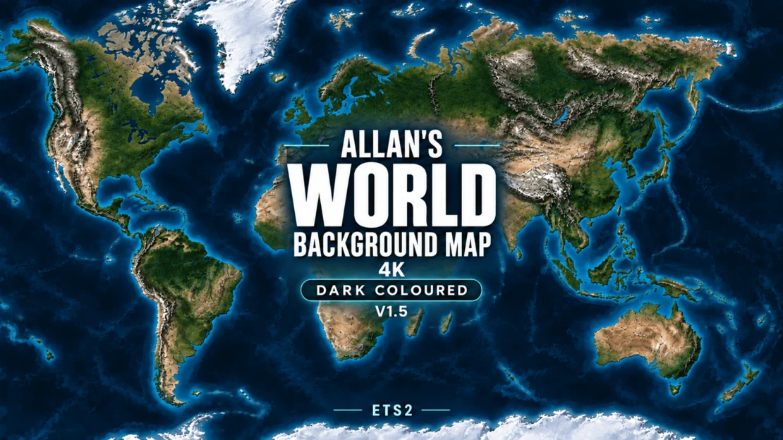
Allan’s World Background Map 4K
A detailed world-map background for Euro Truck Simulator 2, featuring light shaded terrain, natural land colours, clear coastlines and muted blue water.
Designed for use with map combinations, with original background islands for Grand Utopia, Vanemap and PJ Indo, plus a separate fictional island for Antarctica.
V1.5 – Coastline and island improvements
This update improves background alignment around:
• Visby and Gotland.
• Southeast Iceland near Reyðarfjörður and Höfn.
• Eastern Orkney near Kirkwall.
• Southern Kuressaare.
• Ventspils.
• The Curonian Spit near Zelenogradsk.
• The northern shore around Patras.
• Argostoli, including the southwest access road and terminal area.
The update retains the earlier UK map-display alignment, Wick and Exeter refinements, corrections around Kerch, Taman, Anapa and Mariupol, and the Montpellier–Marseille and western Corsica/Ajaccio improvements.
Existing terrain detail, the Light colour scheme, resolution, zoom settings and World Map interface correction are retained.
Some local coastal offsets remain, including the larger road loops near Birsay. The eastern Orkney improvement is a partial correction. Alignment can vary with your installed map combination.
Installation and load order
• Enable this background in Mod Manager.
• Activate only one background-map edition at a time.
• Disable previous editions and other background maps.
• Place this background above your gameplay map packages.
• FullScreen Maps is optional. If used, place it above this background and use a version suitable for your game.
• Use either the Workshop version or the standalone download, not both together.
This mod provides the visual map background. Roads, cities and playable areas come from the game and your installed map mods.
Credits
Created by Allan.
Geography: Natural Earth (public domain).
Terrain: Mapzen/Tilezen Terrain Tiles.
Adapted by Allan: geographic reprojection, regional fitting, relief shading, colour grading, original fictional islands and texture compression. Source providers do not endorse these modifications. This is a game background, not a navigational or survey map.
Terrain provider acknowledgements
• ArcticDEM terrain data DEM(s) were created from DigitalGlobe, Inc., imagery and funded under National Science Foundation awards 1043681, 1559691, and 1542736.
• Australia terrain data © Commonwealth of Australia (Geoscience Australia) 2017.
• Austria terrain data © offene Daten Österreichs – Digitales Geländemodell (DGM) Österreich.
• Canada terrain data contains information licensed under the Open Government Licence – Canada.
• Europe terrain data produced using Copernicus data and information funded by the European Union – EU-DEM layers.
• Global ETOPO1 terrain data: U.S. National Oceanic and Atmospheric Administration.
• Mexico terrain data source: INEGI, Continental relief, 2016.
• New Zealand terrain data Copyright 2011 Crown copyright (c) Land Information New Zealand and the New Zealand Government (All rights reserved).
• Norway terrain data © Kartverket.
• United Kingdom terrain data © Environment Agency copyright and/or database right 2015. All rights reserved.
• United States 3DEP (formerly NED) and global GMTED2010 and SRTM terrain data courtesy of the U.S. Geological Survey.
Global NOAA source credit: DOC/NOAA/NESDIS/NCEI > National Centers for Environmental Information, NESDIS, NOAA, U.S. Department of Commerce. Incorporated US government material is not subject to copyright protection within the United States.
Sources and licence information
https://www.naturalearthdata.com/about/terms-of-use/
https://www.naturalearthdata.com/downloads/10m-raster-data/10m-natural-earth-2/
https://registry.opendata.aws/terrain-tiles/
https://github.com/tilezen/joerd/blob/master/docs/attribution.md
Display-coordinate reference:
https://github.com/simroads/ts-map/blob/master/TsMap/Helper.cs
Sprogø shoreline: © OpenStreetMap contributors, derived from relation 7141469. Source and game-coordinate derived data are distributed under ODbL 1.0. The island artwork uses Allan’s existing palette; no OpenStreetMap rendered tiles were copied.
https://www.openstreetmap.org/relation/7141469
https://www.openstreetmap.org/copyright
https://opendatacommons.org/licenses/odbl/1-0/
Source geometry and derived data are included with the standalone package and as clearly labelled source-data comments in the Workshop manifest.